
 A SCHOLARLY BOOK REPOSITORY
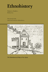
Essays featured in this issue analyze the use of cartography to communicate the urban form of early colonial Mexico City and the application of botanical and protochemical knowledge to make ink for native maps from Oaxaca. Other essays address the representation of ethnicity and space in seventeenth-century Manila, the construction of spatial boundaries through the use of word and image in central Mexico, and the survival of Nahua place names and social ordering in eighteenth-century Mexico City.
Alexander Hidalgo is Assistant Professor of Latin American History at Texas Christian University. John F. López is a Provost’s Postdoctoral Scholar at the University of Chicago.

Trail of Footprints offers an intimate glimpse into the commission, circulation, and use of indigenous maps from colonial Mexico. A collection of sixty largely unpublished maps from the late sixteenth to the eighteenth centuries and made in the southern region of Oaxaca anchors an analysis of the way ethnically diverse societies produced knowledge in colonial settings. Mapmaking, proposes Hidalgo, formed part of an epistemological shift tied to the negotiation of land and natural resources between the region’s Spanish, Indian, and mixed-race communities. The craft of making maps drew from social memory, indigenous and European conceptions of space and ritual, and Spanish legal practices designed to adjust spatial boundaries in the New World. Indigenous mapmaking brought together a distinct coalition of social actors—Indian leaders, native towns, notaries, surveyors, judges, artisans, merchants, muleteers, collectors, and painters—who participated in the critical observation of the region’s geographic features. Demand for maps reconfigured technologies associated with the making of colorants, adhesives, and paper that drew from Indian botany and experimentation, trans-Atlantic commerce, and Iberian notarial culture. The maps in this study reflect a regional perspective associated with Oaxaca’s decentralized organization, its strategic position amidst a network of important trade routes that linked central Mexico to Central America, and the ruggedness and diversity of its physical landscape.
READERS
Browse our collection.
PUBLISHERS
See BiblioVault's publisher services.
STUDENT SERVICES
Files for college accessibility offices.
RECENTLY PUBLISHED


 the Feminine: Bande Dessinée and Women")


UChicago Accessibility Resources
home | accessibility | search | about | contact us
BiblioVault ® 2001 - 2024
The University of Chicago Press